
Mapa topográfico Mammoth Mountain
Mapa interactivo
Haga clic en el mapa para ver la altitud.
Acerca de este mapa
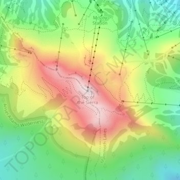
Nombre: Mapa topográfico Mammoth Mountain, altitud, relieve.
Altitud media: 3,011 m
Altitud mínima: 2,730 m
Altitud máxima: 3,368 m
Mammoth Mountain is a lava dome complex in Mono County, California. It lies in the southwestern corner of the Long Valley Caldera and consists of about 12 rhyodacite and dacite overlapping domes. These domes formed in a long series of eruptions from 110,000 to 57,000 years ago, building a volcano that reaches 11,059 feet (3,371 m) in elevation. During this time, massive dacite eruptions occurred roughly every 5000 years. The volcano is still active with minor eruptions, the largest of which was a minor phreatic (steam) eruption 700 years ago.
Otros mapas topográficos
Haga clic en un mapa para ver su topografía, su altitud y su relieve.
Lake Mary
United States > California > Mono County > Mammoth Lakes
Lake Mary, Mammoth Lakes, Mono County, California, United States
Altitud media: 2,866 m