
Mapa topográfico Mount Sunflower
Mapa interactivo
Haga clic en el mapa para ver la altitud.
Mount Sunflower
Mount Sunflower, although not a true mountain, is the highest natural point in the U.S. state of Kansas. At 4,039 feet (1,231 m), it is 3,300 feet (1,010 m) above the state's topographic low point, which lies on the opposite side of the state. It is located between the communities of Kanorado and Weskan in Wallace County, less than half a mile (0.8 km) from the state border with Colorado and is close to the lowest point in Colorado.
Acerca de este mapa
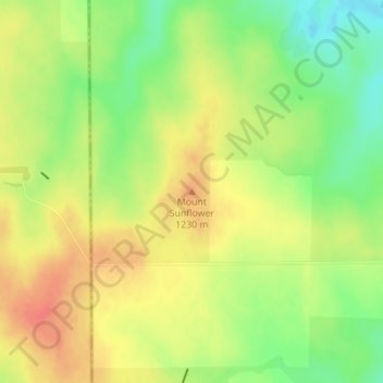
Nombre: Mapa topográfico Mount Sunflower, altitud, relieve.
Lugar: Mount Sunflower, Wallace County, Kansas, United States (39.02188 -102.03730 39.02198 -102.03720)
Altitud media: 1,215 m
Altitud mínima: 1,186 m
Altitud máxima: 1,239 m
Otros mapas topográficos
Haga clic en un mapa para ver su topografía, su altitud y su relieve.