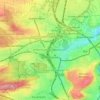
Mapa topográfico Stuttgart
Haga clic en el mapa para ver la altitud.
Stuttgart
Stuttgart covers an area of 207.35 km2 (80 sq mi) and sits at elevation ranging from 207 m (679 ft) above sea level by the Neckar river to 549 m (1,801 ft) on Bernhartshöhe hill – something rather unique in large German cities. The most prominent elevated locales in Stuttgart are the Birkenkopf (511 m (1,677 ft)) on the edge of the Stuttgart basin, the Württemberg (411 m (1,348 ft)) rising above the Neckar valley, and the Grüner Heiner (395 m (1,296 ft)) at the northeast end of the city.
Acerca de este mapa
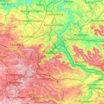
Nombre: Mapa topográfico Stuttgart, altitud, relieve.
Altitud media: 353 m
Altitud mínima: 187 m
Altitud máxima: 549 m
Otros mapas topográficos
Haga clic en un mapa para ver su topografía, su altitud y su relieve.
Zuffenhausen
Germany > Baden-Württemberg > Stuttgart
Zuffenhausen's terrain, a river valley carved into existence by the Feuerbach river, has two distinct elevations: Zuffenhausen with an average of 255 m (837 ft) and Zazenhausen at 252 m (827 ft). To the north and northwest are the vast stretches of the Langes Feld rolling hills on a height of over 300 m (980…
Altitud media: 301 m