
Mapa topográfico Sri Muktsar Sahib
Mapa interactivo
Haga clic en el mapa para ver la altitud.
Acerca de este mapa
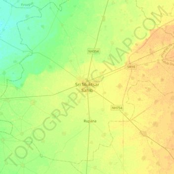
Nombre: Mapa topográfico Sri Muktsar Sahib, altitud, relieve.
Altitud media: 197 m
Altitud mínima: 185 m
Altitud máxima: 207 m
The average land elevation of the city is 648.52 feet (197.67 metres) above sea level. Lithologically, Muktsar is a part of the vast Indo-Gangetic alluvial plain, composed of alternate bands of sands, silt and clay with pebbles. Sandy plains, sand dunes and topographic depressions are the common landforms.