
Mapa topográfico Burj Umar Idris
Mapa interactivo
Haga clic en el mapa para ver la altitud.
Burj Umar Idris
Bordj Omar Driss lies at an elevation of 354 metres (1,161 ft) at the south-western end of the Hamada de Tinrhert Desert, a vast rocky region of the Sahara Desert that extends eastwards into Libya. To the south of the town is an area of sand dunes, beyond which lies the mountain range Djebel Essaoui Mellene, an extension of the Tassili n'Ajjer range.
Acerca de este mapa
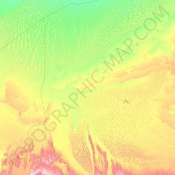
Nombre: Mapa topográfico Burj Umar Idris, altitud, relieve.
Lugar: Burj Umar Idris, In Amenas District, Illizi, 33003, Algeria (26.26393 5.63844 30.14219 8.93103)
Altitud media: 440 m
Altitud mínima: 214 m
Altitud máxima: 1,508 m
Otros mapas topográficos
Haga clic en un mapa para ver su topografía, su altitud y su relieve.