
Mapa topográfico Malad Gorge State Park
Mapa interactivo
Haga clic en el mapa para ver la altitud.
Acerca de este mapa
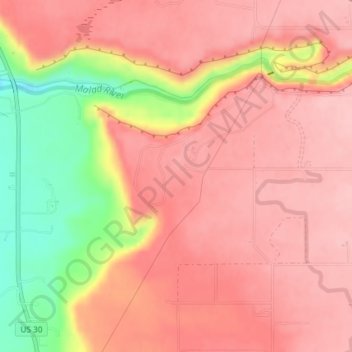
Nombre: Mapa topográfico Malad Gorge State Park, altitud, relieve.
Altitud media: 958 m
Altitud mínima: 856 m
Altitud máxima: 1,002 m
Otros mapas topográficos
Haga clic en un mapa para ver su topografía, su altitud y su relieve.
Hagerman
United States > Idaho > Gooding County
Hagerman, Gooding County, Idaho, 83332, United States
Altitud media: 900 m
Ritter Island
United States > Idaho > Gooding County
Ritter Island, Gooding County, Idaho, United States
Altitud media: 943 m
Wendell
United States > Idaho > Gooding County > Wendell
Wendell, Gooding County, Idaho, 83355, United States
Altitud media: 1,044 m
Bliss
United States > Idaho > Gooding County
Bliss, Gooding County, Idaho, United States
Altitud media: 962 m