
Mapa topográfico Guadalupe River
Mapa interactivo
Haga clic en el mapa para ver la altitud.
Acerca de este mapa
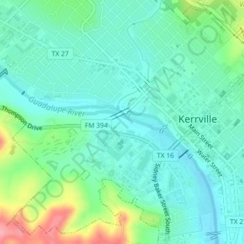
Nombre: Mapa topográfico Guadalupe River, altitud, relieve.
Altitud media: 510 m
Altitud mínima: 483 m
Altitud máxima: 589 m
Otros mapas topográficos
Haga clic en un mapa para ver su topografía, su altitud y su relieve.
Kerrville-Schreiner Park
United States > Texas > Kerr County > Kerrville
Kerrville-Schreiner Park, 2385, Kerrville, Kerr County, Texas, 78028, United States
Altitud media: 496 m