Mapas topográficos Hesse
Haga clic en un mapa para ver su topografía, su altitud y su relieve.






Flieden
Germany > Hesse > Landkreis Fulda
Flieden is located in a valley north west of the Landrücken between the Vogelsberg and the Rhön. It is an area of low hills with the highest elevations being Knöschen near Buchenrod (509 m) and the Storker Küppel near Oberstork (470 m). At the very center of Flieden the creeks Magdloser Wasser und Kautzer…
Altitud media: 376 m




Wiesbaden
The highest point of the Wiesbaden municipality is located northwest of the city center near the summit of the Hohe Wurzel, with an elevation of 608 metres (1,995 ft) above sea level. The lowest point is the harbour entrance of Schierstein at 83 metres (272 ft) above sea level. The central square (the…
Altitud media: 258 m

Wiesbaden
The highest point of the Wiesbaden municipality is located northwest of the city center near the summit of the Hohe Wurzel, with an elevation of 608 metres (1,995 ft) above sea level. The lowest point is the harbour entrance of Schierstein at 83 metres (272 ft) above sea level. The central square (the…
Altitud media: 221 m


Hadamar
Germany > Hesse > Landkreis Limburg-Weilburg
Hadamar lies 7 km north of Limburg between Cologne and Frankfurt am Main on the southern edge of the Westerwald at elevations from 120 to 390 m above sea level.
Altitud media: 215 m


Wetzlar
Germany > Hesse > Lahn-Dill-Kreis
Wetzlar has a year-round temperate seasonal climate of the middle latitudes. Between the different elevations there are different small climatic conditions. The daily mean temperature in summer is about 17 to 18 °C (63 to 64 °F) and in winter about 1 to 2 °C (34 to 36 °F). The average rainfall is 600 to…
Altitud media: 228 m
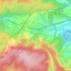
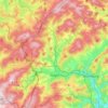
Taunus
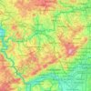
Hintertaunus is the name given to the area north of the Hoher Taunus up to the Lahn valley. The landscape here is lower and less mountainous than in the southern Taunus. Between the valleys, some of which are quite deep, there are pronounced plateaus (leveled areas) with heavy agricultural use. Since mostly…
Altitud media: 280 m
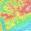
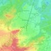
Dietzenbach
Germany > Hesse > Landkreis Offenbach
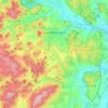
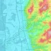
Hexenberg, whose name is German for “Witches’ Mountain”, is a constituent community. It is named after the highest elevation in Offenbach district. The buildings are mostly relatively low one-family and multiple-family dwellings as well as a few smaller shops in the middle of the community.
Altitud media: 155 m

Bad Hersfeld
Germany > Hesse > Landkreis Hersfeld-Rotenburg
The Flugplatz Johannesberg has the status of Special Airfield. The runway, some 671 m long and 18 m wide, is paved with asphalt and oriented in a north–south direction. The airfield lies on the Johannesberg in the like-named outlying centre at an elevation of 284 m above sea level.
Altitud media: 305 m
Wald-Michelbach
Germany > Hesse > Kreis Bergstraße > Wald-Michelbach > Wald-Michelbach
Altitud media: 396 m
Milseburg
Germany > Hesse > Landkreis Fulda
The Milseburg is an extinct volcano and at 835 metres (2,740 ft) above sea level the second highest elevation in the Hessian part of the Rhön Mountains, Germany. The hill is located east of Fulda, near the villages of Kleinsassen and Danzwiesen. It is a popular destination for hikers and bikers.…
Altitud media: 619 m



Bad Hersfeld
Germany > Hesse > Landkreis Hersfeld-Rotenburg
The Flugplatz Johannesberg has the status of Special Airfield. The runway, some 671 m long and 18 m wide, is paved with asphalt and oriented in a north–south direction. The airfield lies on the Johannesberg in the like-named outlying centre at an elevation of 284 m above sea level.
Altitud media: 281 m
Eschborn
Germany > Hesse > Main-Taunus-Kreis
Eschborn provides expansive views of the Taunus mountain ranges, especially the 'Altkönig' and behind it the 'Feldberg' up to elevations of around 880 m above sealevel. From Eschborn to the north there are numerous hiking and biking trails leading up to these green mountain zones. In winter, along and up…
Altitud media: 146 m
Igstadt
Igstadt is situated on the eastern slope of the Wäschbachtal valley at an elevation of 169 to 211 m above sea level. It is traversed by the Wiesbaden-Niedernhausen rail line. It is surrounded by agricultural land. Recreational areas include the Wickerbachtal Nature Reserve between Igstadt and Kloppenheim.
Altitud media: 198 m

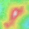
Großer Feldberg
Germany > Hesse > Hochtaunuskreis > Schmitten im Taunus
The Großer Feldberg ('Great Field Mountain') is, at a height of 879.5 metres, the highest elevation of the Taunus mountains, and of the entire Rhenish Massif. It is situated in the Hochtaunuskreis district in Hesse, Germany.
Altitud media: 716 m


Hohenroda
Germany > Hesse > Landkreis Hersfeld-Rotenburg
The municipality lies between the Rhön and the Thuringian Forest (ranges) in the so-called Kuppen Rhön. The highest elevation in the Hessian Skittles (a range of volcanic mountains), the Soisberg, stands at the western municipal limits.
Altitud media: 341 m