
Haz una donación
Mapa topográfico Sumner Lake State Park
Haga clic en el mapa para ver la altitud.
Haz una donación
Sumner Lake State Park
The park features a large 4,500-acre (18 km2) reservoir on the Pecos River, created in 1939 by the Sumner Dam of the United States Bureau of Reclamation. The reservoir is home to various fish species including largemouth bass, catfish, crappie and walleye. The park elevation is 4,300 feet (1,300 m) above sea level. With its campground, expansive views of the sky, and its distance from other cities, Sumner Lake State Park has a low level of light pollution, which makes the state park a great potential place for amateur astronomy.
Haz una donación
Acerca de este mapa
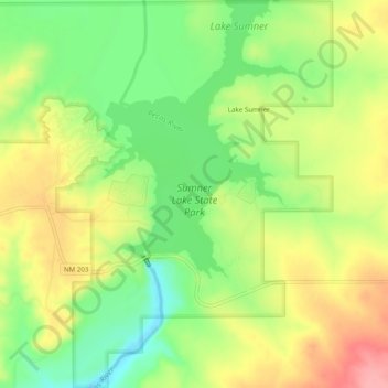
Nombre: Mapa topográfico Sumner Lake State Park, altitud, relieve.
Altitud media: 1,311 m
Altitud mínima: 1,262 m
Altitud máxima: 1,364 m
Haz una donación
Otros mapas topográficos
Haga clic en un mapa para ver su topografía, su altitud y su relieve.