
Gracias por apoyar a este sitio ❤️
Haz una donación
Haz una donación
Mapa topográfico White Mesa
Haga clic en el mapa para ver la altitud.
Gracias por apoyar a este sitio ❤️
Haz una donación
Haz una donación
Acerca de este mapa
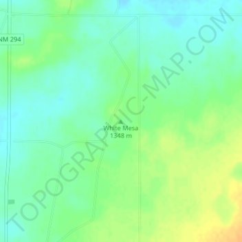
Nombre: Mapa topográfico White Mesa, altitud, relieve.
Lugar: White Mesa, De Baca County, New Mexico, United States (34.29113 -103.98613 34.29123 -103.98603)
Altitud media: 1,348 m
Altitud mínima: 1,336 m
Altitud máxima: 1,365 m
Gracias por apoyar a este sitio ❤️
Haz una donación
Haz una donación
Otros mapas topográficos
Haga clic en un mapa para ver su topografía, su altitud y su relieve.
Sumner Lake State Park
United States > New Mexico > De Baca County
The park features a large 4,500-acre (18 km2) reservoir on the Pecos River, created in 1939 by the Sumner Dam of the United States Bureau of Reclamation. The reservoir is home to various fish species including largemouth bass, catfish, crappie and walleye. The park elevation is 4,300 feet (1,300 m) above sea…
Altitud media: 1,311 m