
Mapa topográfico Eichenzell
Haga clic en el mapa para ver la altitud.
Acerca de este mapa
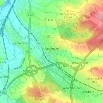
Nombre: Mapa topográfico Eichenzell, altitud, relieve.
Lugar: Eichenzell, Landkreis Fulda, Hesse, Germany (50.47801 9.68474 50.51130 9.74868)
Altitud media: 302 m
Altitud mínima: 256 m
Altitud máxima: 379 m
Otros mapas topográficos
Haga clic en un mapa para ver su topografía, su altitud y su relieve.
Milseburg
Germany > Hesse > Landkreis Fulda
The Milseburg is an extinct volcano and at 835 metres (2,740 ft) above sea level the second highest elevation in the Hessian part of the Rhön Mountains, Germany. The hill is located east of Fulda, near the villages of Kleinsassen and Danzwiesen. It is a popular destination for hikers and bikers.…
Altitud media: 619 m