
Mapa topográfico Elanthoor
Mapa interactivo
Haga clic en el mapa para ver la altitud.
Acerca de este mapa
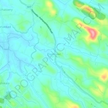
Nombre: Mapa topográfico Elanthoor, altitud, relieve.
Altitud media: 38 m
Altitud mínima: 7 m
Altitud máxima: 156 m
Otros mapas topográficos
Haga clic en un mapa para ver su topografía, su altitud y su relieve.
Aranmula
India > Kerala > Kozhencherry
Aranmula, Kozhencherry, Pathanamthitta District, Kerala, 689533, India
Altitud media: 14 m