
Mapa topográfico Aranmula
Mapa interactivo
Haga clic en el mapa para ver la altitud.
Acerca de este mapa
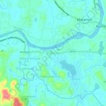
Nombre: Mapa topográfico Aranmula, altitud, relieve.
Altitud media: 14 m
Altitud mínima: -1 m
Altitud máxima: 79 m
Aranmula is located at 9°20′N 76°41′E / 9.33°N 76.68°E / 9.33; 76.68. It has an average elevation of 7 m (23 ft).
Otros mapas topográficos
Haga clic en un mapa para ver su topografía, su altitud y su relieve.
Elanthoor
India > Kerala > Kozhencherry
Elanthoor, Kozhencherry, Pathanamthitta District, Kerala, 689643, India
Altitud media: 38 m