
Mapa topográfico Alsfeld
Haga clic en el mapa para ver la altitud.
Alsfeld
The Pfefferhöhe rest area near Alsfeld is the second highest rest area (in altitude) along the A 5, the and also a popular meeting place.
Acerca de este mapa
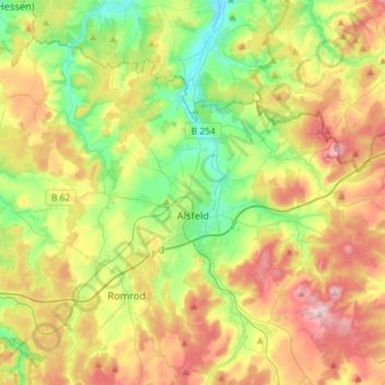
Nombre: Mapa topográfico Alsfeld, altitud, relieve.
Lugar: Alsfeld, Vogelsbergkreis, Hesse, 36304, Germany (50.69798 9.17093 50.82661 9.46126)
Altitud media: 331 m
Altitud mínima: 220 m
Altitud máxima: 487 m
Otros mapas topográficos
Haga clic en un mapa para ver su topografía, su altitud y su relieve.